So on day 2 in Switzerland I decided to hike the eiger trail from Grindelwald to Lauterbrunnen via Kleine Scheidegg and the Eigergletscher. I took the early morning train to Grindelwald from Interlaken Ost. A pretty short and uneventful ride preceeding a long and exciting hike. From there I hiked down (seemed like the wrong direction to be heading) into Grindelwald Grund where I quickly found the trail I needed. From there I began the hike up into Brandeg where there was a train station and a restaurant. The picture below is of the cog railway leading into Brandeg. I didn't stop here and didn't see anyone else either though the sign said they served breakfast (it was right at about 9:00 am...must not be very good breakfast). I followed the signs further heading towards Alpiglen.

These are photos looking back across the valley in the opposite direction to where I was going. I'm not sure what mountain this is but its the one just east of Monch (anyone who knows can inform me).

These are photos looking back across the valley in the opposite direction to where I was going. I'm not sure what mountain this is but its the one just east of Monch (anyone who knows can inform me).
A delightful set of stairs in the trail with a welcomed hand hold...this would have been better coming down I think than going up when my legs were still pretty fresh. The clouds had really started to come in at this point and I was concerned about rain (or snow at the top). Luckilly things stayed overcast until I reached the top and then cleared up just in time to make me really sweat on the way down.
I saw some wildlife on the way...like these sheep and horses. Well they weren't actually WILD life they were domestic but they were the only animals I saw for close to four hours until I got to the other side of the valley. They were pretty high up and I couldn't see any farmer's barns near by and I didn't cross any fences so i wonder if they just stay where they are all the time???
Looking back down across the auto road into grindelwald...its starting to get kind of far away at this point as I approach alpiglen but I'm still feeling pretty good at this point. The mountains in front of me are still covered in clouds so its hard to see how far I have to go...probably a good thing.
Waterfall number one of the day...a little outside of Alpiglen.
Looking back again onto grindelwald as I approached tree line for the first time this hike. Clouds are starting to be at eye level now which was weird. Makes for some tricky hiking because the fog got REALLY thick in places.
The glacier is starting to come into play here. The snow looks like rolled out carpet on the side of the mountain. I made a snowball here and threw it at these french people and then blamed Klaus for the assault...OK, I didn't do that, they were actually dutch not french.

This is me...I was really there. This is at the base of the Eiger's north face. It pretty much goes straight up from this point. I'm glad I wasn't climbing that too. Yikes!
Looking up at the north face...can't see much but you can tell its STEEP.
A cool little stream had cut this snow cave out. There was probably a good 3-4 ft. of snow on top of this little "bridge".


Getting close to the top here. I'm just past Kleine Scheidegg and heading upwards on to Eiger Gleitscher. The people in the picture were an older british couple that offered me a cup of tea at a little rest stop (how quaint).


A little trail marker (cairn) garden that someone or many made. This is when I was really starting to feel the altitude difference. I had gained around 4500 ft in elevation or about 9/10ths of a mile (straight up). I was also running a bit low on water and was starting to get hungry (it had been almost 3 hours since breakfast and 1.5 hours since that bannana.
At the TOP I stoped in at the restaurant (lots of people here...they took the train) and had an amazing meal. It was pork cordon bleu with a salad and fries. Who knew that a pork chop stuffed with gruyere cheese, and ham, and then DEEP FRIED, could be so good. Actually, I knew. I mean come-on...its pork stuffed with ham and then fried...I called it the kosher nightmare and I also called it delicious. The picture is a bit decieving because it makes the plate look small, but in reality the dish is easily more than 12 inches across. I also had a cappucino and a cup of tea before leaving. It cost me close to $30US...but I would have paid fifty.


A view from the porch of the restaurant...pretty breathtaking in real life...not so much in this picture.


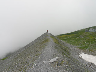
I left through the back door of the restaurant and it dumps you on this trail going out. On the right is a modest 80ft. drop. On the left is a crazy 400 ft drop...you take your steps carefully. The people in the distance were americans and were on their honeymoon...I passed them a bit later and they decided to turn back and take the train down (I scoffed at the time but later thought maybe they were smarter than I).

One of the ubiquitous trail markers on this section.
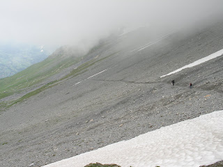
A view down towards where I was finally going to end up. In the distance you can just barely make out a later section of the trail. I'm still way above tree line but at least I could see them again.


Another huge cairn garden creation. The tallest ones here were almost over my head. I added a small rock to a shorter one as a mark of my trip.


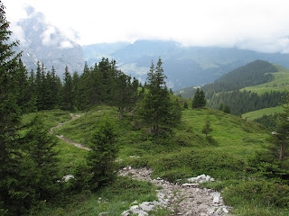
The first trees on the way down...a welcomed sight as the sun was starting to come out again. It got noticeably warmer at this point and I took off the long pants, fleece, and hat.


Goats in my way...they clearly didn't care I was there but gave me evil looks...demon goats I think.

Looking across the Lauterbrunnen valley for the first time...my train station is at the very bottom of this. I was getting a little nervous about my knees at this point. Alas, I made it in the end but felt the effects for DAYS to come.

A waterful and an opportunity for me to get "artsy" with my photography
Looking across the Lauterbrunnen valley for the first time...my train station is at the very bottom of this. I was getting a little nervous about my knees at this point. Alas, I made it in the end but felt the effects for DAYS to come.

Swiss trail construction reminds me of the game "Mousetrap." Ok so hiker trips on log and knocks over pole which lets water break roll down hill pinning the hiker to a tree...you WIN.

"Artsy again"

I looked backwards a lot and this one was worth it. You can see the trail going back up to where I came from and on the left is the Eiger and the right is Jungfrau...the Eiger might look bigger but is actually a few metres shorter than Jungfrau.
Civilization thank goodness...but no cars in this town, I guess the roads don't make it so far. Everyone gets around on foot or by bike (mostly mopeds though).

If you chicken out you can take the cable car down. I'm glad I didn't but at the time it seemed like a nice option.


No comments:
Post a Comment